Tatsfield has been served by the 464 route since 1998, though it only came under the London Buses umbrella in 2000, coinciding with the start of Tramlink. In fact, if not for the 464, Tatsfield would be cut off almost entirely from London, or even the rest of the country. There are only two other bus routes, one of which is a school route, and the nearest train station is nearly four miles away down in Oxted. I'd like to imagine the 464 is more than welcome here, what with its half-hour frequency and link to the trams in New Addington.
.HEIC)
Tatsfield dates back to the times of the Domesday Book (then called Tatelefelle), with its name seemingly having an unclear origin. Whether its etymology is linked with that of neighbouring Titsey, I'm not certain. Tatsfield has had a lengthy history as a manor, having been under the ownership of the Bishop of Bayeux in 1086, and afterwards shifted between the hands of many lords, which I wouldn't be able to aptly summarise.
Tatsfield was also tragically the site of what was, at the time, the deadliest plane crash in UK history. On 10th December 1935, a SABENA aircraft was flying en route from Brussels to Croydon, when it crashed on Kemsley Road, killing all eleven on board.
Tatsfield Village
When you get to Tatsfield, you won't find much in the village centre. There are various small businesses, including the local pub, Ye Old Ship. The Tatsfield Village Club can also be found here - they offer bingo on Monday and poker on Sunday, but they open at 3pm most of the week - any meetups are limited for after work. There's a small war memorial in the centre, the British flag flying proud beside it, and there's even a village pond as well.
.HEIC)
.HEIC)
Otherwise...that's it. Tatsfield isn't a commercial and entertainment hub, and it's all the better for it. However, that did mean that, unless I wanted to immediately go back into London, I'd have to wander into the countryside, along busy roads where cars seek the M25.
.HEIC) |
| The Tatsfield Family Portrait |
Onwards and upwards
I gladly did so. It's worth saying that on my stroll, I only encountered two people using the earthy pavement - an elderly man walking his dog, as well as a woman jogging. Both were heading towards Tatsfield.
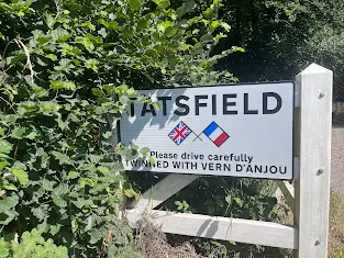
The Tatsfield Scouts, the Tatsfield Jiu Jitsu program, even Tatsfield Aquatics, with a sign stating they were open, were all places I saw on my brief 15 minute walk away from the village. It was rather cool whilst walking, mainly as I was surrounded by woodland which created a large shaded space, though eventually the road turned, and light appeared from the countryside. This also happened to be the end of Tatsfield, as some road signs read. "TATSFIELD - South and South East in Bloom Award Winning Village", read one; the other advertised their twinning with Vern-d'Anjou, a French commune.
It appears the latter twinning came about in 1975 after the mayors of the respective villages sent letters to each other, and they've been holding regular Easter exchanges between each other ever since. This link also means there's a Rue de Tatsfield in France! Technically, Vern-d'Anjou apparently doesn't exist anymore - it merged with several communes to form Erdre-en-Anjou - but that shouldn't diminish this wonderful random association.

On the right - the "Award Winning Village" side - is a large field full of crops, and in the backdrop is a rather stunning view of the patchworked Surrey countryside. We're right at the beginning of the North Downs, a series of chalk hills and woodland which covers large swathes of Surrey, and this area is designated as an Area of Natural Beauty. Tatsfield happens to be positioned on a region of high relief - it's Surrey's highest village, in fact - which would explain the sweeping view even from afar, just behind the plants. The photos don't exactly demonstrate how lovely the view was - any more zoomed in and the images become blurry - but I think they're nice either way.
 |
| The start of the North Downs |
On the "Vern-d'Anjou" side lies a grassy field, dotted with two towers. This happens to be the remnant of Tatsfield Receiving Station, established by the BBC in 1929 to monitor radio broadcasts and ensure the right programs were transmitted at the right frequencies - initially domestic broadcasts, come WW2 the scope was expanded to monitoring transmissions from Europe, the US, and Japan. Tatsfield was the centre of BBC Monitoring, whose job was to monitor war-time radio during the war, though Tatsfield's importance declined after the war ended and the government slashed the BBC's budget. Despite this, Tatsfield became the first receiver in the UK to detect signals from Sputnik in 1957. Come 1974, Tatsfield's time would be up - the station closed and was left to rot. Here's a website detailing its glory; here's one about its death (and which I'm thankful for providing information about the site).
.HEIC)
From here, I decided to go back to the village; though I could have wandered further down to Titsey, it would have added nearly an hour to my journey - the optional bus was in an hour, anyways. Yet as I walked back to the village centre, I realised how tranquil life could feel - being able to hear distinct birdsong without cars and muttering around you, cool air against one's skin; it's a different style of living to the bustle of London. Tatsfield is all the better for it.
.HEIC)
I also recommend this brief episode of Secret Surrey discussing Tatsfield during snowfall. All the more delightful for those interested in Surrey's history, you can find fifty-four other episodes here.
Comments
Post a Comment